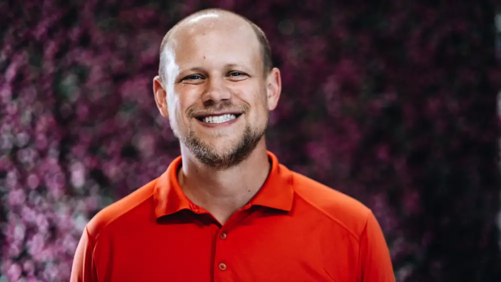
Name
Erika Espeland
Age
39
Company/Organization
Berrien County GIS Department
What Does Your Company/Organization Do?
Berrien County’s Geographic Information Systems (GIS) department is the county’s geospatial command center. The GIS department is responsible for collecting, managing, analyzing, and visualizing geospatial data to support informed decision-making across the county. This includes creating and maintaining detailed static and dynamic maps, managing geospatial databases, developing web applications and tools, and conducting spatial analysis to identify patterns, trends, and relationships. The department supports a wide range of functions such as planning, taxation, elections, public safety, critical infrastructure, emergency response, and public transparency. By integrating geographic data with other information systems, the department helps government, agencies, businesses, and the public work more efficiently, solve complex problems, and communicate insights through interactive, map-based tools & applications.
Education
Masters in Geographic Information Science: Central Michigan University (2009) Bachelor of Science in Geographic Information Science & Anthropology: Central Michigan University (2007) Drones in the Field- Open-source Solutions for Data Collection, Processing, & Analysis: Michigan State University Study Abroad: University of Ghana (2005-2006) Broken Mammoth Archaeological Field School: University of Alaska (2005)
Accomplishments
Currently serving as the GIS Director for Berrien County, leading modernization efforts and Enterprise GIS deployment, as well as, Remonumentation Grant Administrator, Berrien County Broadband Internet Task Force (BCBIT), 911 Advisory Board & Emergency Operations Planning Team Established the first-ever GIS department at Cass County, served as its inaugural GIS Director and deployed Enterprise GIS systems. Honors: Founding member of the State of Michigan’s GIS Advisory board comprised of the top 17 geospatial professionals from various entities Cum Laude Dean’s list Awards: MiCamp Board of Directors Geospatial Service Award National Ambassador Torch Award for volunteer work – Business Professionals of America 1st place IMAGIN GIS Competition 3rd place IMAGIN Graduate paper Competition Highlighted Exhibitor Student Creative Research Exhibit: Central Michigan University Scholarships: Mark Clute Opportunity Scholarship Board of Directors Academic Honors Scholarship Michigan Merit Scholarship Award Leslie Lieberman Social Science Scholarship Central Michigan University Office of International Education Scholarship Interdisciplinary Field School Scholarship. Leadership: Vice President of the State’s GIS Professional organizations: Michigan Communities Association of Mapping Professionals (MiCAMP) & Community of Michigan Professionals Advancing Spatial Sciences (CMPASS) Featured speaker and round table host at many state & national geospatial conferences & events Frequent Guest speaker at several universities/colleges Service: Subcommittee Member – Improving Michigan’s Access to Geographic Information Networks (IMAGIN) Board Member – MI GROWTH Board Member – DTMB Michigan State Remote Sensing Working Group Certifications: Over 200 hours for continued education with the ESRI Academy NACo Professional Development Academy: High Performance Leadership (12 week Class) FEMA Emergency Management sUAS: Drones for Public Safety/Services
What else do you hope to accomplish by the age of 40?
I hope to solidify the foundation of Berrien County’s GIS modernization and increasing collaboration with various governmental and private entities, agencies & partners. On a broader level, I hope to strengthen regional partnerships, contribute meaningfully to the state GIS advisory board, and keep advocating for long-term sustainability in government geospatial programs.
Current City
Baroda, Michigan
Place You Were Born
Missoula, Montana
What was your first job?
Summer Camp Counselor & riding instructor at Mystic Lake YMCA
What’s the best advice you ever got?
Begin before you feel prepared. Speak while your voice still carries doubt. Lead even as your hands tremble. Transformational growth doesn’t happen in comfort or quiet. It happens when you step forward into the unknown.
Who inspires you most?
The next generation of GIS Professionals.
That one thing about you we’d be most surprised to learn.
I have completed both the Steelhead Ironman & Sunburst Marathon.
What do you love to do in your downtime?
If I ever had any downtime, it is my lifelong dream to enjoy a nap.
What book are you reading now?
Barking Up the Wrong Tree: The Surprising Science Behind Why Everything You Know About Success Is Mostly Wrong by Eric Barker
Volunteer activity you love the most.
Mentoring other GIS professionals & speaking to high school students about the career possibilities in the field of GIS.
What motivates you to give back to your community?
What keeps me motivated are the small victories…watching someone I’ve mentored grow into a confident leader or seeing a GIS product we built lead to a smarter decision, a quicker emergency response, or an enhanced visualization of a complex issue.
What Superpower would you most love to have?
Ability to telepathically access and integrate data from any source, because in GIS, the hardest part isn’t analysis, it’s the hunt! The schema & format mismatches, the licensing roadblocks, the missing metadata, the “oh we kept all that info in a handwritten ledger that only Dan Fette is smart enough to interpret.” If I could skip all that, GIS would finally become what it was meant to be: a catalyst for action.
What would you like to leave behind as your legacy once you are gone?
I want to leave behind a geospatial system so well-built, intuitive, and deeply integrated into the fabric of government operations that it continues to evolve and serve long after I’m gone. Most of all, I want to leave behind a team that thrives without me. A team that is empowered, collaborative, and capable of pushing boundaries without my guidance.
What does the honor of being named to the 40 Under 40 most mean to you?
Winning 40 Under 40 is incredibly meaningful to me because it reflects the impact of work that often goes unseen. Most people don’t know what “GIS” is, yet they often use this technology often throughout the day. Whether they’re checking a map, looking up property data, getting directions, or tracking a snowplow, GIS is quietly working in the background. It’s the invisible backbone of smarter government, faster emergency response, and better public services. I’ve dedicated my career to building these systems, mentoring others, and making sure GIS isn’t just a tech tool, but a catalyst for transparency, efficiency, and equity. This award tells me that work matters. It gives me the momentum to keep spreading awareness, lifting others up, and pushing for technological innovation in every corner of government.


