When it comes to who owns what land and where all of the proper boundary lines lie there’s actually a science of sorts to all of that, and in the modern era while things have gotten easier…sorting it all out is still a monumental task. Or, should we say — REmonumental task?
More than 200 years ago, surveyors accompanied by chainmen, axe men, hunters, and cooks set out across the land now known as Michigan to chart and mark the land for settling. Today, surveyors, equipped with trucks, shovels, GPS, and excavation equipment, are walking in the footsteps of their predecessors to find evidence of that original work through a program called remonumentation.
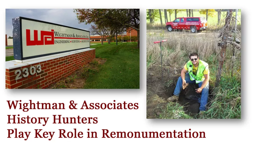
Remonumentation involves the search for the original survey corner locations set during the 1800s. It is important because these corners define nearly the entire land ownership system throughout the state. Publically elected county surveyors administer and oversee this work in most of Michigan’s 83 counties. The surveying, engineering, and architectural firm of Wightman & Associates, Inc. is in the unique position of having three such individuals on staff.
In 1815, the United States government developed the public land survey system to logically and systematically divide and sell land west of the thirteen colonies to pay for the war debt. The U.S. government began dispatching surveyors into territory that would eventually become the State of Michigan. It took 40 years for them to canvas the rugged wooded terrain dotted with rivers, lakes, and streams. They left behind simple wooden stakes to mark a ½ mile grid of corner points covering 96,716 square miles of the Great Lakes State. These stakes became the first markers, or monuments, of corners that became the backbone for defining legal land ownership. Roughly two centuries later, these points continue to function in this official duty.
Many of the monuments were maintained, preserved, replaced, and documented over time, while much evidence of other section corners has faded into obscurity. Loss of monuments made surveying more time consuming and more expensive, and it opened the door to increases in survey discrepancies.
Michigan lawmakers recognized the problem and in 1990 created legislation to fund an effort to remonument the approximately 300,000 corners throughout the state. According to the Office of Land Survey & Remonumentation, this is the first time since surveyors finished establishing the original corner positions in 1855 that a concerted statewide effort has been made to identify and remark these historic points.
The County Surveyors in Michigan are the stewards of the United States Public Land Survey corners and other property controlling points within their respective jurisdictions. They also store and safeguard historic county survey records and assist other surveyors in locating survey information. But arguably, the biggest portion of their elected duty is guiding the work of the remonumentation program.
Three of these elected officials perform this important public service in addition to their full-time positions with Wightman & Associates.
- John Kamer, a 42 year WAI licensed surveyor based in the company’s Benton Harbor office, has been Berrien County Surveyor since 2000 and spearheaded the implementation of the remonumentation program in Berrien County in 1990. Prior to Kamer’s election as County Surveyor, WAI’s then-president Maurice Rushlow served as County Surveyor until his passing in 2000.
- Gary Hahn, who has been with the company for 35 years and is based in the WAI Portage office, has served as Kalamazoo County Surveyor since 2008.
- Kevin Miedema, a 14-year WAI employee, was elected as Allegan County Surveyor this past November, and works out of the company’s Allegan office.
County surveyors work county grant administrators who manage the annual remonumentation budget allocated by the State. The County Surveyors also organize and implement the plan of work and chair their county’s professional surveyor peer review group. While the counties largely work independently on the project, having three county surveyors working for the same company provides a layer of support.
Miedema says, “This is my first year as Allegan County Surveyor. It’s very nice having two experienced county surveyors within our organization to lean upon for advice based on their experience within the program.”
Additionally, Greg Vaughn, Ottawa County’s former Remonumentation Representative is the newest addition to the cadre of professional surveyors at WAI. Greg spearheaded one of only 2 expedited county remonumentation efforts in the state and coordinated with MDOT for the installation of 4 Continuously Operating Reference GPS Stations (CORS) now used by surveyors throughout Ottawa, Kent, Muskegon and Allegan Counties.
The United States government initiated the process in 1815 to survey the land mass that would later become the State of Michigan. A north/south meridian was established stretching from Defiance, Ohio, to Sault Ste. Marie, and an intersecting east/west baseline was identified that borders Kalamazoo County.
Working off the meridian and baseline, surveyors began subdividing the land into six-mile square townships. All townships in Michigan are referenced by their north or south relationship to the baseline, and by their east or west relationship to the meridian. Field workers then subdivided the townships into square-mile segments with corners marked each half mile using simple wooden stakes or stones.
Original survey work in Kalamazoo County occurred from 1825 to 1830, in Allegan County from 1830 to 1834, and in Berrien County from 1828 to 1845. Government work to survey and monument the entire state was completed in 1855.
While, generations of surveyors have perpetuated and preserved many corner monuments, other section corners have succumbed to the elements or disappeared. In many cases, the original stakes were later replaced using stones, clay tiles, or whatever was available. The surveyors recorded descriptions of what objects were used as well as a narrative about nearby reference points including bearings and distances to trees, buildings, and other fixed objects to assist those looking for these points in the future.
Hahn, Kamer, and Miedema develop yearly remonumentation project plans based on the State funding allocation for their respective counties. Funding fluctuates based on the number of statewide land transfers, each of which is assessed a $4 fee to fund the remonumentation project. For 2017, Allegan and Kalamazoo counties have each been awarded $88,000 and Berrien County has been awarded $68,900.
The number of corners each county chooses to work on in any given year is based on the amount of money available. The number of corners varies from year to year, and from county to county. Part of the selection process includes a review of current projects within the county and upcoming road construction projects.
Hahn tells us, “Corner monuments can often be lost during excavation, so we consider those located in construction areas to be most urgent. We also would rather not disturb pavement when we can avoid it, so doing the work before the onset of construction makes the most sense.”
Allegan, Berrien, and Kalamazoo counties each have approximately 3,000 section corners. This year Allegan County has 75 corners slated for remonumentation, while Kalamazoo County has identified 33 to 38 corners on which to work. Berrien County plans to work on 41 section corners in 2017.
Retracing the location of original corners requires today’s surveyors to be part historian, part detective, and part archeologist. They rely on documents that have come down through the decades to glean information about how the corners have been perpetuated and preserved. Those, coupled with the original surveyors’ account of monument placement, are what survey teams today rely upon to begin the hunt for corner monuments.
Kamer says, “If original landscape reference points such as trees and buildings are gone, we look at newer recorded accounts of these points to help us know where to look. We also use other nearby points that have already been remonumented and employ the assistance of GPS to help us narrow down the location of where we should begin the search.”
Hahn explained that Kalamazoo County is fortunate to have good records dating from 1860 to around 1910 which indicate the type of monumentation previous surveyors used to perpetuate the positions of section corners. He says, “If you know what you are looking for and don’t find it where you initially think it should be and there is no apparent reason for it to have been removed, then the question of where and how far afield to continue the search must be considered. At this point, persistence and good ‘retracement’ skills become important.”
Once the corner location has been determined, the contract surveyor will submit all evidence for review by a peer group comprised of local professional surveyors. The peer group evaluates the documentation and the physical findings with the goal of obtaining consensus as to whether the corner position has been properly perpetuated. Once approved as to location, a Land Corner Recordation Certificate is recorded with the Register of Deeds and a dossier is prepared for the evidence obtained in perpetuating the corner position.
Miedema recounts one such experience when a section corner had three possible positions. He says, “A survey firm had set a new iron where they believed the section corner to be in 1982. There was also a position established by another surveyor around that time about 30 feet to the north. Our research revealed that a stone was called for in notes from 1877 as a perpetuation of the position of the original General Land Office stake. After additional measurements, we identified a search position for this stone. Upon digging in the gravel road, we located the stone within two feet of our search position. All peer members agreed that the stone was in the correct original position.” He adds, “Clearing up situations such as these is one of the most important outcomes of the program.”
Sometimes the search is relatively straightforward. Other times, surveyors have to move mountains of earth to find the elusive prize. As Hahn tells us, “A number of years ago we were trying to recover a section corner that was monumented with an ‘earthen post’ covered by ‘ashes from my fire’ set by County Surveyor Francis Hodgman around 1875.” He notes, “This corner fell on the side of a ravine and a road had been constructed over it. The road was being reconstructed so we had access to a large backhoe which we used to excavate through 13 feet of fill sand. We unearthed a 3-foot diameter circle of white granular sand, which was the remnant from the referenced fire ashes. Beneath it we found the “earthen post” in the center of the circle. That was a fun find.”
If a section corner’s location is determined lost or obliterated, surveyors weigh all available evidence and procedures to determine the corner position and place a new monument.
The effort that goes into remonumentation can be tremendous, but the benefits are considerable given that nearly the entire property ownership structure within the state depends on points marked nearly two centuries ago. Those benefits include:
- Reduction in the cost of surveys – by making verified section corners easier to find, it lessens the amount of time surveyors spend in the field and drives down the price of surveys for consumers and businesses.
- Reduction in the number of boundary disputes – having peer reviewed reference points from which to work makes boundary determination a more straightforward and accurate process.
- Increased accuracy of surveys – this is vital because every property in the state is measured from and defined by the local section corners.
- A reliable base for GIS databases – precise corners verified through the remonumentation process serve as a base for geographic information systems (GIS) available for public, businesses, and government use.
- Perpetuation of land records for future generations – with recorded Land Corner Recordation Certificates as well as magnetized markers that are more easily found, future surveyors will have a solid foundation of information from which to work.
When statewide remonumentation launched in the 1990s, widely held estimates for its completion stood at 20 years. Unanticipated project complexities and decreases in funding during the real estate downturn that begin in 2008 have created a different reality. Allegan County has identified and remonumented approximately 70 percent of its sections corners. Kalamazoo County stands at approximately 60 percent. Berrien County has completed approximately 47 percent.
Kamer says, “It’s difficult for any of us to estimate when work will be finished because funding can be unpredictable as we’ve seen over the past several years.” He points out, “It is all dependent on a mix of funding and challenges in the field.”
When remonumentation is complete, county surveyors will focus their attention on maintaining the new markers to save future generations from having to once again painstakingly go through the process.
Hahn says, “Everyone who works on the remonumentation program, from the County Surveyors to the field teams doing the searching and digging, is truly part of an historical event. This is an opportunity to level a mark on the public land survey system.” And, he says, “In 100 years, surveyors will be referencing our work and retracing our steps, just as we are retracing the footsteps of those who have done this work in Michigan over the last two centuries.”
Miedema added, “It is gratifying to know that our work is keeping the chain of history going.”
Wightman & Associates, Inc. is a civil engineering, architectural, and survey firm that has been serving Southwest Michigan and Northern Indiana since 1946 with offices in Benton Harbor, Portage, and Allegan.