
If you’ve seen those helicopter flights involving a 60-foot wide sensor hoop taking place around Southwest Michigan this spring and have questions, the Michigan Department of Environment, Great Lakes, and Energy is planning an open house for this month to explain.
We reported last month that EGLE is teaming up with the U.S. Geological survey for the flights, carrying a hexagonal antenna about 200 feet above the ground to scan the subsurface. The department’s Sydney Ruhala explained.
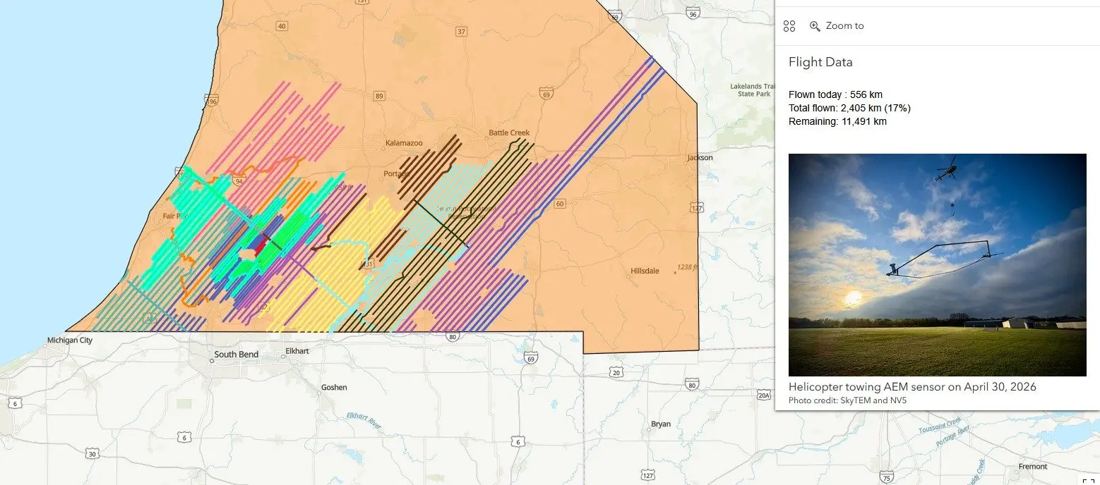
“It’s an airborne electromagnetic survey,” Ruhala said. “It covers portions or all of about 16 counties in Southwest Michigan, and what it does is it’s a helicopter that tows what looks like a hula hoop underneath it. The hoop itself is about 100 feet above the ground surface, and then the helicopter is maybe another 100 feet or so above that. So it’s relatively low-altitude. And they fly over pre-designated flight lines, like paths that we’ve picked out, and the hula hoop that they’re towing has scientific instruments attached to it that are measuring differences in the electrical magnetic properties of the subsurface within the rocks and soil types that we have in the subsurface.”
Ruhala says these scans can tell researchers quite a bit.
“It’s measuring those differences, which tells us a lot about what is in the ground surface. It can tell us the depth to bedrock, if we’ve got sands and gravels beneath the subsurface, if we have clay in certain areas. So it helps us essentially create a three-dimensional map of the geology in our subsurface across Southwest Michigan.”
Ruhala tells us they’re looking for groundwater to help improve water quality protection efforts.
“But then it’s also helpful for communities that maybe they need to install new drinking water wells to supply water to a community that it may help them find the best spots to install those wells. So it has a lot of different benefits, I think, to having this additional data.”
Some people have asked if the flights are intended to help plan for data centers, and the answer is no.
“This is not directly related to data centers. We are looking at better understanding our groundwater resources at a regional scale. So understanding the geology, it’s not so much focused on any one water user or anything like that. And so the data will have a lot of different uses, but it’s not specifically related to data centers or that in kind of any realm, any other individual user.”
Whatever their purpose, people have been asking questions when they spot those choppers passing overhead with their huge antennas. That’s why EGLE will host the open house on May 19 in Marshall.
“It’s an event that the United States Geological Survey, other geophysicists and some of their other scientists will be there. Members from EGLE will be there. And then SkyTEM, which is the company that is actually conducting the flights, they are the pilots that are flying the helicopter. They will be present as well.”
The open house will be at 10 a.m. on Tuesday, May 19, at Brooks Field Airport, in Marshall. Ruhala says the helicopters and their equipment will be there for people to examine themselves. Everyone’s welcome.